Getting around
Interactive Big Canoe community map
Drag to move around, pinch or use the buttons to zoom, and tap any place below to jump straight to it. Big Canoe has over 8,000 acres of mountain roads, so this map is the easiest way to picture where everything sits before you arrive.
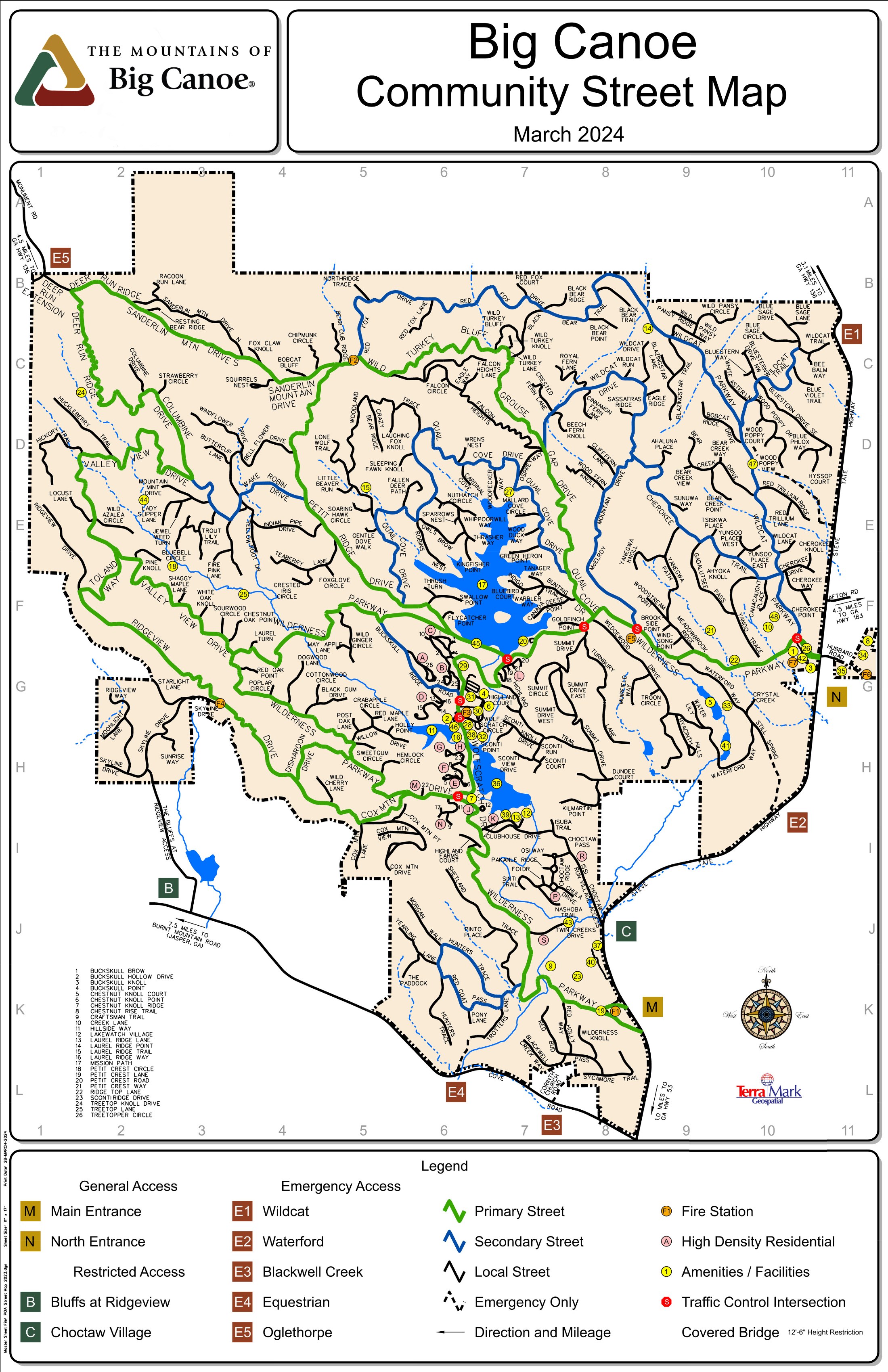
Official Big Canoe POA community street map. Handy to save on your phone — cell service can be patchy on the ridges.
Which gate to use
Both gates work for guests. The North Gate is closest to groceries and coffee; the Main Gate is the classic entrance and closest to Lowes Foods.
Please drive gently
Big Canoe speed limits are enforced by laser, and tickets can be issued without being pulled over. The roads are winding and deer are everywhere.
Registered in advance
We register every guest and vehicle with security before arrival. Let us know if your group is coming in more than one car.